|
Geography and social life
 Mykonos lies in the center of the Aegean to the southeast of
Tinos. It is approximately 85 square kilometer and a
population of approximately 6000. It can be reached both by
air and sea. During the season, there are several flights from
Athens and connections with Crete, Santorini, Rhodes, Samos
and Mytilini. The airport is a destination of charter flights
from several European countries. Mykonos is also surrounded by
about 11 islets, favorable for fishing, diving and
wind-surfing. Rhenia is approximately four times the Delos
island and separated from the latter by a channel of 700
meters at its narrowest point. Actually it consists by two
parts linked by a very narrow isthmus. Rhenia is, like Delos,
hilly and treeless. A small number of local farmers live and
graze their coveys there. By sea Mykonos is reachable from
both Piraeus and Rafina. In the summer season there are many
connections with other Greek islands including Ios, Santorini,
Naxos, Paros, Samos and Rhodes. Flying dolphins as well as
catamarans make the same journey shorter, but there is always
the alternative of a cruising along Evia, Andros and Tinos.
 Sea transportation and timetables can be effected by the «Meltemi»
(a strong wind which often blows from the north during summer
especially in August). The terrain of Mykonos is mostly stony
and hilly. The highest point is «Profitis Ilias Anomeritis»
and «Profitis Ilias Vorniotis». The island is almost
treeless. In spring time Mykonos becomes verdant, as the wild
flowers bloom for a short time, before they die by the
dazzling summer sun. The lack of potable water is a problem.
People are forced to use old wells when the desalination plant
fails to provide enough and the ships are unable to dock due
to rough seas. The island produces very little. Fresh fruit
and vegetables arrive by boat, but local melons are
particularly recommended. You may still see locals with mules
selling local products. Locals still produce their own wine,
although their is no commercial utilization. Sea transportation and timetables can be effected by the «Meltemi»
(a strong wind which often blows from the north during summer
especially in August). The terrain of Mykonos is mostly stony
and hilly. The highest point is «Profitis Ilias Anomeritis»
and «Profitis Ilias Vorniotis». The island is almost
treeless. In spring time Mykonos becomes verdant, as the wild
flowers bloom for a short time, before they die by the
dazzling summer sun. The lack of potable water is a problem.
People are forced to use old wells when the desalination plant
fails to provide enough and the ships are unable to dock due
to rough seas. The island produces very little. Fresh fruit
and vegetables arrive by boat, but local melons are
particularly recommended. You may still see locals with mules
selling local products. Locals still produce their own wine,
although their is no commercial utilization.
One of the most
famous products is «kopanisti» (a special kind of cheese) on
which «mostra» (a local delicacy) is based. In the past,
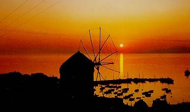
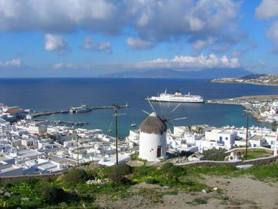
there was a great product of flour as there were about 28
windmills operating although for the local needs only 2 would
be enough. Lead, silver and barite deposits of the island ran
low, but evidences still exist at Kalo Livadi. Mykonians
earned their living from both the sea and the land. Nowadays,
the greatest source of income is tourism and its associated «industries».
Through the winter months, the majority of the islanders are
occupied in building-constructing and renovating their
properties to be ready for the next season.
 The natural sources of the island is the sun, the sea and the wind,
elements that helped developing a unique tourist resort with
an international reputation. The monadic architecture style
has also played its own part as such the hospitality,
adaptability, tolerance and wit of the Mykonians. They have
remained simple, direct people even though more than 10
millions of people visit their native land influence them
every year.
The island has a continuous development due to
good communication links with the mainland and the other
islands as with the rest of Europe during the summer season.
Some of the traditions and customs of the island are still
alive and observed nowadays. For example on the «Epiphany Day»
-the locals call it «the Cross day», everyone goes to the
harbor. After the Mass, the priest throws an ancient and
priceless cross into the water. Then the local young men dive
for it into the sea The one who retrieves it, is both blessed
with good luck and rewarded, for his successful effort into
the cold winter waters of the harbor. On «Clean Monday»
(shrove Monday & the first day of the Lent) there is a
great exodus to the countryside, especially to the beaches,
for kite-flying and pick-nick with seafood and Lenten snacks.
 The Mykonian carnival, which lasts for three weeks, is one of
the most impressive, while locals dressed with fancy clothes
and masks walk around the town, teasing people and making
jokes. The roads of the island are in a satisfactory
condition, thanks to the Local Authorities efforts, but the
weather and the land, has as result dangerous road curves and
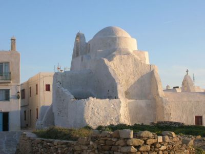
road edges. The Mykonian tradition to build low stone walls
around their land properties, blindfolds the drivers to
estimate right the curves. So low speed is strongly
recommended. Stone walls are not built, just bunches of rocks,
placed the one on the other and fixed by cement on the top. The Mykonian carnival, which lasts for three weeks, is one of
the most impressive, while locals dressed with fancy clothes
and masks walk around the town, teasing people and making
jokes. The roads of the island are in a satisfactory
condition, thanks to the Local Authorities efforts, but the
weather and the land, has as result dangerous road curves and
road edges. The Mykonian tradition to build low stone walls
around their land properties, blindfolds the drivers to
estimate right the curves. So low speed is strongly
recommended. Stone walls are not built, just bunches of rocks,
placed the one on the other and fixed by cement on the top.
|
>> Cyclades Islands : Amorgos, Anafi,
Andros, Antiparos,
Delos, Folegandros,
Ios, Kea,
Kimolos, Kithnos,
Koufonisia, Milos,
Mykonos, Naxos,
Paros, Santorini,
Serifos, Sifnos,
Sikinos, Syros,
Tinos.
|
|